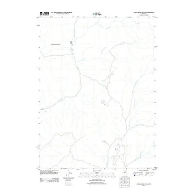
2012 Map of Santa Renia Fields
USGS Topo · Published 2012About this map
Santa Renia Fields serves as a primary marker in this high-desert region of Elko County, where the landscape is defined by the eastern slopes of the Santa Renia Mountains. This early 21st-century survey documents a network of primitive roads and drainage systems that support local ranching and land management. The terrain is characterized by significant natural landmarks such as Round Mountain and The Grade, which overlook a complex system of seasonal waterways including Antelope Creek, Little Coyote Creek, and Boulder Creek.
Find a feature on this map
11 named features on this map. Tap any name to fly to it.
Don’t see what you’re looking for? This feature index may not catch every label — zoom into the map to look around manually.
Map Details
Editions of this 2012 Santa Renia Fields Map
This is the sole edition of this map. No revisions or reprints were ever made.
Other maps of this area

1955 · McDermitt
USGS Topo · 1:250,000

1955 · Winnemucca
USGS Topo · 1:250,000

1958 · Winnemucca
USGS Topo · 1:250,000

1959 · McDermitt
USGS Topo · 1:250,000

1962 · Winnemucca
USGS Topo · 1:250,000

1965 · Willow Creek Reservoir
USGS Topo · 1:24,000

1965 · Sheep Creek Range NE
USGS Topo · 1:24,000
1965 · Willow Creek Reservoir SE
USGS Topo · 1:24,000

1968 · Rodeo Creek NE
USGS Topo · 1:24,000

1968 · Rodeo Creek NW
USGS Topo · 1:24,000