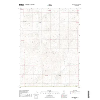
2018 Map of Santa Renia Fields
USGS Topo · Published 2018About this map
Santa Renia Fields occupies a high-elevation basin in Northern Nevada, defined by the drainage patterns of several seasonal watercourses. The Santa Renia Mountains dominate the northwestern sector of the map, rising above the surrounding flats. This landscape is characterized by its isolation, with the drainage of Alkali Cr and Squaw Cr carving distinct paths through the terrain. To the south, Round Mtn stands as a prominent topographical landmark near the winding course of Bell Cr. The area is largely defined by the Public Land Survey System grid, which segments the open range of Elko County. The topography here suggests a high-desert environment where water is the primary architect of the land, visible in the many draws such as Antelope Draw that cut across the fields.
Find a feature on this map
17 named features on this map. Tap any name to fly to it.
Don’t see what you’re looking for? This feature index may not catch every label — zoom into the map to look around manually.
Map Details
Editions of this 2018 Santa Renia Fields Map
This is the sole edition of this map. No revisions or reprints were ever made.
Other maps of this area

1955 · McDermitt
USGS Topo · 1:250,000

1955 · Winnemucca
USGS Topo · 1:250,000

1958 · Winnemucca
USGS Topo · 1:250,000

1959 · McDermitt
USGS Topo · 1:250,000

1962 · Winnemucca
USGS Topo · 1:250,000

1965 · Willow Creek Reservoir
USGS Topo · 1:24,000

1965 · Sheep Creek Range NE
USGS Topo · 1:24,000
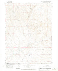
1965 · Willow Creek Reservoir SE
USGS Topo · 1:24,000

1968 · Rodeo Creek NE
USGS Topo · 1:24,000

1968 · Rodeo Creek NW
USGS Topo · 1:24,000