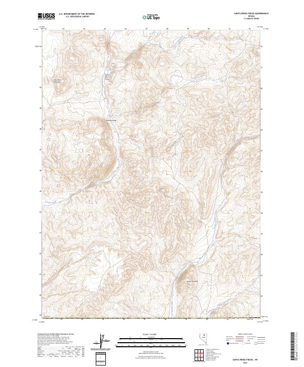
2023 Map of Santa Renia Fields
USGS Topo · Published 2023About this map
Santa Renia Mountains dominate the western portion of this Northern Nevada landscape, giving way to the high desert basin of Santa Renia Fields. This 2023 survey illustrates the complex drainage network of northern Elko County, where intermittent and perennial watercourses like Antelope Creek and Alkali Creek have carved distinct features into the terrain. The presence of Davu'tsi Naokwaide in the northeast reflects indigenous toponyms preserved alongside later settler names. The topography is defined by significant elevation changes, notably around Antelope Draw and the prominence of Round Mountain to the south. This map provides a contemporary view of the remote ranching and grazing lands that characterize the Great Basin, capturing the relationship between sparse upland water sources like Little Coyote Creek and the broader watershed of Boulder Creek.
Find a feature on this map
20 named features on this map. Tap any name to fly to it.
Don’t see what you’re looking for? This feature index may not catch every label — zoom into the map to look around manually.
Map Details
Editions of this 2023 Santa Renia Fields Map
This is the sole edition of this map. No revisions or reprints were ever made.
Other maps of this area

1955 · McDermitt
USGS Topo · 1:250,000

1955 · Winnemucca
USGS Topo · 1:250,000

1958 · Winnemucca
USGS Topo · 1:250,000

1959 · McDermitt
USGS Topo · 1:250,000

1962 · Winnemucca
USGS Topo · 1:250,000

1965 · Willow Creek Reservoir
USGS Topo · 1:24,000

1965 · Sheep Creek Range NE
USGS Topo · 1:24,000
1965 · Willow Creek Reservoir SE
USGS Topo · 1:24,000

1968 · Rodeo Creek NE
USGS Topo · 1:24,000

1968 · Rodeo Creek NW
USGS Topo · 1:24,000