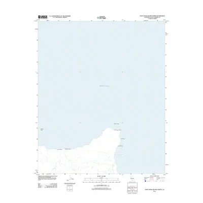
2012 Map of Santa Rosa Island North
USGS Topo · Published 2012About this map
Carrington Point anchors the northern coastline of Santa Rosa Island in this survey of the Channel Islands. The map documents a maritime landscape defined by hazardous features like Beacon Reef and Rodes Reef, alongside sheltered points such as Coati Point and Corral Point. These coastal markers serve as primary navigational aids for the Pacific Ocean approaches to the island's northern shore.
Find a feature on this map
9 named features on this map. Tap any name to fly to it.
Don’t see what you’re looking for? This feature index may not catch every label — zoom into the map to look around manually.
Map Details
Editions of this 2012 Santa Rosa Island North Map
This is the sole edition of this map. No revisions or reprints were ever made.
Other maps of this area
1943 · Santa Rosa Island East
USGS Topo · 1:24,000
1943 · Santa Rosa Island North
USGS Topo · 1:24,000

1948 · Santa Maria
USGS Topo · 1:250,000

1949 · Los Angeles
USGS Topo · 1:250,000

1949 · Long Beach
USGS Topo · 1:250,000

1955 · Los Angeles
USGS Topo · 1:250,000

1956 · Santa Maria
USGS Topo · 1:250,000

1957 · Long Beach
USGS Topo · 1:250,000

1957 · Santa Maria
USGS Topo · 1:250,000

1958 · Santa Maria
USGS Topo · 1:250,000