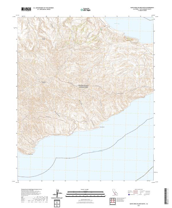
2021 Map of Santa Rosa Island South
USGS Topo · Published 2021About this map
Santa Rosa Island rises from the Pacific Ocean south of Santa Barbara, characterized by the winding ridges of Sierra Pablo and deep drainage systems. As part of Channel Islands National Park, the landscape is marked by a network of unimproved routes such as Quinn Knob Road Trl and Sierra Pablo Road Trl that navigate the island's steep interior. The southern coastline is defined by prominent landforms including South Point and Ford Point, which provide natural landmarks for the coastal waters of Johnsons Lee.
Find a feature on this map
24 named features on this map. Tap any name to fly to it.
Don’t see what you’re looking for? This feature index may not catch every label — zoom into the map to look around manually.
Map Details
Editions of this 2021 Santa Rosa Island South Map
This is the sole edition of this map. No revisions or reprints were ever made.
Other maps of this area
1943 · Santa Rosa Island East
USGS Topo · 1:24,000
1943 · Santa Rosa Island South
USGS Topo · 1:24,000
1943 · Santa Rosa Island North
USGS Topo · 1:24,000

1948 · Santa Maria
USGS Topo · 1:250,000

1949 · Los Angeles
USGS Topo · 1:250,000

1949 · Long Beach
USGS Topo · 1:250,000

1955 · Los Angeles
USGS Topo · 1:250,000

1956 · Santa Maria
USGS Topo · 1:250,000

1957 · Long Beach
USGS Topo · 1:250,000

1957 · Santa Maria
USGS Topo · 1:250,000