
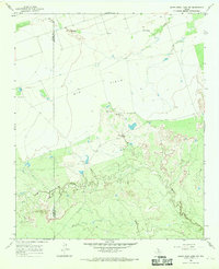
1966 Map of Santa Rosa Lake SW
USGS Topo · Published 1968About this map
The North Wichita River winds through the southwestern corner of this landscape, marking a remote stretch of North Texas where the boundaries of Baylor, Foard, and Knox counties meet. Surveyed in the mid-1960s, the terrain is defined by a dense network of intermittent drainages like Crooked Creek and Rose Hollow Creek that carve through the prairie toward the larger river systems. This is a region of traditional ranching operations, centered on working landmarks such as Corral and the Waggoner area, reflecting the expansive cattle heritage of the Rolling Plains. The northern portion of the map is dominated by the course of South Beaver Creek, illustrating the complex water rights and land divisions in a territory where an Indefinite Boundary still persisted between Wilbarger and Baylor counties at the time of the survey.
Find a feature on this map
12 named features on this map. Tap any name to fly to it.
Don’t see what you’re looking for? This feature index may not catch every label — zoom into the map to look around manually.
Map Details
Editions of this 1966 Santa Rosa Lake SW Map
This is the sole edition of this map. No revisions or reprints were ever made.
Other maps of this area

1954 · Wichita Falls
USGS Topo · 1:250,000

1958 · Wichita Falls
USGS Topo · 1:250,000

1966 · Santa Rosa Lake
USGS Topo · 1:24,000

1966 · Soap Creek
USGS Topo · 1:24,000

1966 · Colwell Creek
USGS Topo · 1:24,000

1966 · Vera
USGS Topo · 1:24,000

1966 · Northwest Lake Kemp
USGS Topo · 1:24,000

1966 · Southwest Lake Kemp
USGS Topo · 1:24,000

1966 · Thalia
USGS Topo · 1:24,000
1966 · Santa Rosa Lake NW
USGS Topo · 1:24,000