
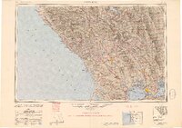
1949 Map of Santa Rosa
USGS Topo · Published 1949About this map
The Northwestern Pacific RR serves as the industrial spine for the North Bay in the late 1940s, connecting a network of agricultural and riverside communities from Petaluma up through Santa Rosa and into the timber and vineyard lands of the Russian River valley. This survey captures the region's transport landscape just as postwar aviation was expanding, evidenced by sites like Santa Rosa Airpark and Hamilton Field.
Find a feature on this map
163 named features on this map. Tap any name to fly to it.
Don’t see what you’re looking for? This feature index may not catch every label — zoom into the map to look around manually.
Map Details
Editions of this 1949 Santa Rosa Map
2 editions found
Other maps of this area

1888 · Marysville
USGS Topo · 1:125,000

1891 · Marysville
USGS Topo · 1:125,000

1894 · Marysville
USGS Topo · 1:125,000

1895 · Marysville
USGS Topo · 1:125,000

1895 · San Francisco
USGS Topo · 1:62,500

1896 · Carquinez Strait
USGS Topo · 1:62,500

1896 · Mt. Diablo
USGS Topo · 1:62,500

1897 · Concord
USGS Topo · 1:62,500

1897 · Tamalpais
USGS Topo · 1:62,500

1898 · Karquines
USGS Topo · 1:62,500