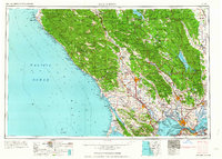
1964 Map of Santa Rosa
USGS Topo · Published 1964About this map
The Russian River valley and the surrounding coastal ranges are captured here just as the Wine Country and North Bay regions were transitioning into their modern forms. This survey highlights significant institutional and military footprints from the early 1960s, including the Mare Island Naval Reservation, the Benicia Arsenal, and Hamilton Air Force Base. The landscape is a complex of agricultural valleys, rancherias such as the Middletown Rancheria, and burgeoning educational centers like Sonoma State College.
Find a feature on this map
133 named features on this map. Tap any name to fly to it.
Don’t see what you’re looking for? This feature index may not catch every label — zoom into the map to look around manually.
Map Details
Editions of this 1964 Santa Rosa Map
This is the sole edition of this map. No revisions or reprints were ever made.
Other maps of this area

1888 · Marysville
USGS Topo · 1:125,000

1891 · Marysville
USGS Topo · 1:125,000

1894 · Marysville
USGS Topo · 1:125,000

1895 · Marysville
USGS Topo · 1:125,000

1895 · San Francisco
USGS Topo · 1:62,500

1896 · Carquinez Strait
USGS Topo · 1:62,500

1896 · Mt. Diablo
USGS Topo · 1:62,500

1897 · Concord
USGS Topo · 1:62,500

1897 · Tamalpais
USGS Topo · 1:62,500

1898 · Karquines
USGS Topo · 1:62,500