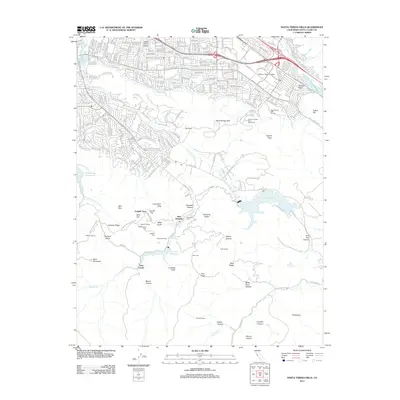
2012 Map of Santa Teresa Hills
USGS Topo · Published 2012About this map
New Almaden and the surrounding mercury mining district anchor this study of the southern Santa Clara Valley foothills. The map documents the intricate cultural landscape of the mine works, featuring English Town, Mexican Camp, and Mine Hill, alongside specialized structures like the Hacienda Tunnel. Genealogists can locate several distinct burial grounds including Hacienda Cem, Old Mexican Cem, and Hidalgo Cem, which reflect the historic ethnic divisions of the mining workforce.
Find a feature on this map
66 named features on this map. Tap any name to fly to it.
Don’t see what you’re looking for? This feature index may not catch every label — zoom into the map to look around manually.
Map Details
Editions of this 2012 Santa Teresa Hills Map
This is the sole edition of this map. No revisions or reprints were ever made.
Other maps of this area

1889 · San Jose
USGS Topo · 1:62,500

1897 · San Jose
USGS Topo · 1:62,500

1897 · Mt. Hamilton
USGS Topo · 1:62,500

1899 · San Jose
USGS Topo · 1:62,500

1916 · New Almaden
USGS Topo · 1:48,000

1917 · Morgan Hill
USGS Topo · 1:62,500

1919 · New Almaden
USGS Topo · 1:62,500

1939 · Morgan Hill
USGS Topo · 1:62,500

1940 · Los Gatos
USGS Topo · 1:62,500

1941 · Morgan Hill
USGS Topo · 1:62,500