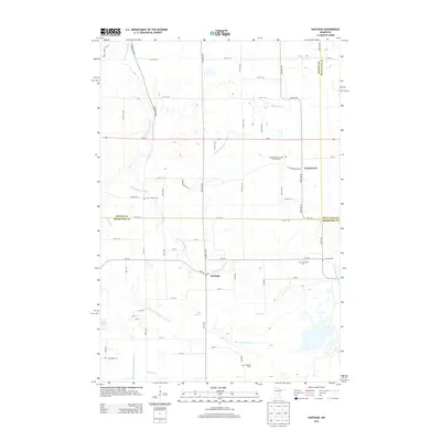
2013 Map of Santiago
USGS Topo · Published 2013About this map
Saint Francis River meanders through this portion of central Minnesota, serving as a primary geographic axis for the settlements of Santiago and Glendorado. The landscape is defined by an extensive drainage network, including County Ditch Number Thirteen and County Ditch Number Twenty-two, which supports the agricultural character of the region. Local history and genealogy are well-represented by a high density of rural burial sites such as Saint Francis Cem, Oak Hill Cem, and the Glendorado Lutheran Church Cem. Small water bodies like Fox Pond and Pool Number 1 dot the terrain, while MN-95 provides the main east-west transit corridor. The map captures the boundary where Benton Co, Mille Lacs Co, and Sherburne Co meet, showing the distribution of family farms and homesteads at the start of the 2010s.
Find a feature on this map
68 named features on this map. Tap any name to fly to it.
Don’t see what you’re looking for? This feature index may not catch every label — zoom into the map to look around manually.
Map Details
Editions of this 2013 Santiago Map
This is the sole edition of this map. No revisions or reprints were ever made.
Other maps of this area

1953 · Stillwater
USGS Topo · 1:250,000

1955 · Stillwater
USGS Topo · 1:250,000

1958 · Stillwater
USGS Topo · 1:250,000

1961 · Clear Lake
USGS Topo · 1:24,000

1961 · Orrock
USGS Topo · 1:24,000

1961 · Becker
USGS Topo · 1:24,000

1961 · Monticello
USGS Topo · 1:62,500

1961 · Elk River
USGS Topo · 1:62,500

1965 · Stillwater
USGS Topo · 1:250,000
1968 · Foley
USGS Topo · 1:24,000