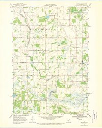
1968 Map of Santiago
USGS Topo · Published 1970About this map
The St Francis River and its meandering tributaries define the low-lying terrain of central Minnesota as it appeared in the late 1960s. This survey captures a rural landscape transitioning into preserved natural space, notably featuring the Sherburne National Wildlife Refuge and the Benlacs State Wildlife Management Area. The small community of Santiago serves as a local hub, supported by a network of one-room schoolhouses like School No 1888 and School No 86 that reflect an earlier era of township organization.
Find a feature on this map
31 named features on this map. Tap any name to fly to it.
Don’t see what you’re looking for? This feature index may not catch every label — zoom into the map to look around manually.
Map Details
Editions of this 1968 Santiago Map
This is the sole edition of this map. No revisions or reprints were ever made.
Other maps of this area

1953 · Stillwater
USGS Topo · 1:250,000

1955 · Stillwater
USGS Topo · 1:250,000

1958 · Stillwater
USGS Topo · 1:250,000

1961 · Clear Lake
USGS Topo · 1:24,000

1961 · Orrock
USGS Topo · 1:24,000

1961 · Becker
USGS Topo · 1:24,000

1961 · Monticello
USGS Topo · 1:62,500

1961 · Elk River
USGS Topo · 1:62,500

1965 · Stillwater
USGS Topo · 1:250,000
1968 · Foley
USGS Topo · 1:24,000