Loading...
Loading map...2022 Map of Santo
USGS Topo · Published 2022About this map
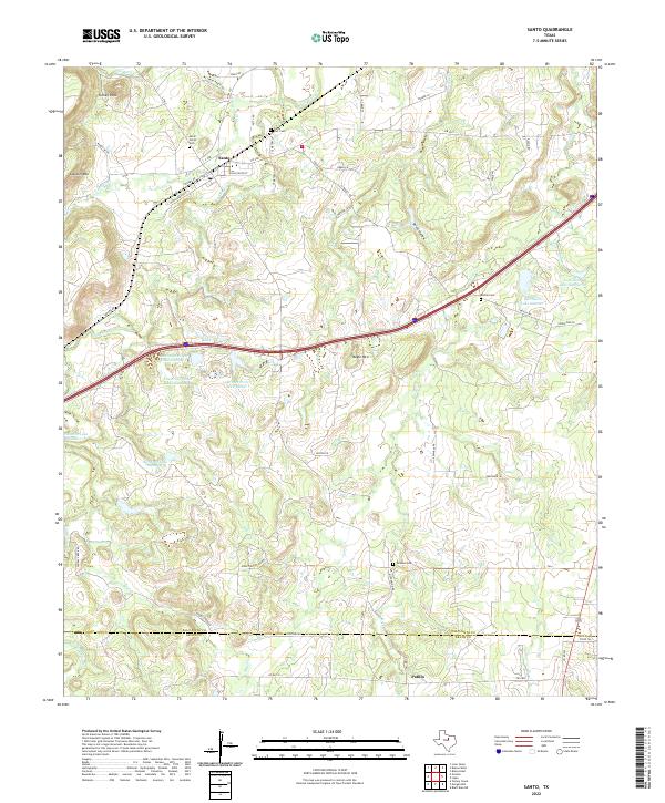
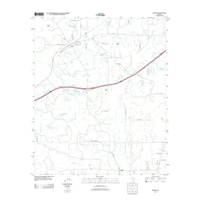
Santo sits at the northern end of this survey, where the drainages of Cantrell Cr and Palo Pinto Cr meet. The landscape is defined by a series of prominent elevations and ridges, including Turkey Peak, Clayton Mtn, and Bugle Mtn, which overlook a network of creek valleys and small water bodies. The presence of several private reservoirs like Lawrence Porter Lake Number 1 and Le Wallen Lake Number 2 suggests a rural economy tied to water management and ranching.
Find a feature on this map
60 named features on this map. Tap any name to fly to it.
Don’t see what you’re looking for? This feature index may not catch every label — zoom into the map to look around manually.
Map Details
Date Portrayed2022
Date Published2022
PublisherU.S. Geological Survey
Map TypeTopographic
Scale1:24,000
Physical Dimensions24 x 29 inches
Editions of this 2022 Santo Map
This is the sole edition of this map. No revisions or reprints were ever made.
Historical Maps of Patillo Through Time
7 maps found
Featured Locations
Source Details
SourceU.S. Geological Survey
CopyrightPublic Domain