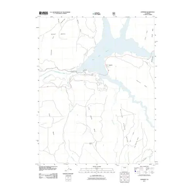
2011 Map of Sapinero
USGS Topo · Published 2011About this map
Blue Mesa Reservoir dominates this landscape, its waters held back by the Blue Mesa Dam along the course of the Gunnison River. The settlement of Sapinero is positioned near the reservoir's eastern reach, surrounded by high plateaus including Soap Mesa, Sapinero Mesa, and Pine Creek Mesa. This 2011 survey documents the area's role as a recreation hub within the Curecanti Natl Rec Area, highlighting infrastructure such as Lake Fork Campground and local routes like County Rd-721. The map reveals a high-desert environment defined by deep gulches, such as Mill Gulch and McIntyre Gulch, and the remote Elizonde Ranch tucked away from the main thoroughfares. It serves as a clear record of the post-dam geography of Western Colorado, where water management and public lands dictate the pattern of human presence.
Find a feature on this map
30 named features on this map. Tap any name to fly to it.
Don’t see what you’re looking for? This feature index may not catch every label — zoom into the map to look around manually.
Map Details
Editions of this 2011 Sapinero Map
This is the sole edition of this map. No revisions or reprints were ever made.
Other maps of this area

1908 · Uncompahgre
USGS Topo · 1:125,000

1911 · Uncompahgre
USGS Topo · 1:125,000

1954 · West Elk Peak SW
USGS Topo · 1:24,000

1954 · Little Soap Park
USGS Topo · 1:24,000

1954 · Cebolla
USGS Topo · 1:24,000

1954 · Sapinero
USGS Topo · 1:24,000

1954 · Gateview
USGS Topo · 1:24,000

1956 · Curecanti Needle
USGS Topo · 1:24,000

1956 · Montrose
USGS Topo · 1:250,000

1957 · X Lazy F Ranch
USGS Topo · 1:24,000