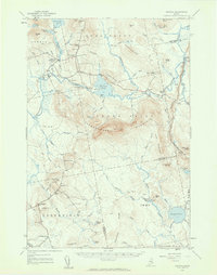
1957 Map of Saponac
USGS Topo · Published 1959About this map
Passadumkeag Mountain dominates the central landscape of this mid-century survey, surrounded by a complex network of waterways including Saponac Pond and the Passadumkeag River. The area shows a distribution of small settlements such as Burlington, Lowell, and Greenfield, each with its own local infrastructure. Genealogists will find several burial grounds noted, including Mt Repose Cem and the numbered Number One Cem and Number Two Cem sites. The timber and water-driven economy of the region is evidenced by the presence of the Thirty-Nine Tannery and various Gravel Pits. Water navigation and measurement are key themes, shown by features like the Lowell Gaging Sta and river hazards such as White Horse Rips and Pond Rips. Educational history is preserved through the locations of the Corner Sch and School No 1.
Find a feature on this map
99 named features on this map. Tap any name to fly to it.
Don’t see what you’re looking for? This feature index may not catch every label — zoom into the map to look around manually.
Map Details
Editions of this 1957 Saponac Map
4 editions found

Other maps of this area

1902 · Orono
USGS Topo · 1:62,500

1917 · Passadumkeag
USGS Topo · 1:62,500

1920 · Winn
USGS Topo · 1:62,500

1929 · Great Pond
USGS Topo · 1:48,000

1929 · Lead Mountain
USGS Topo · 1:48,000

1931 · Springfield
USGS Topo · 1:48,000

1931 · Saponac
USGS Topo · 1:48,000

1932 · Nicatous Lake
USGS Topo · 1:48,000

1932 · Lead Mountain
USGS Topo · 1:62,500

1932 · Great Pond
USGS Topo · 1:62,500