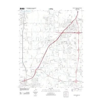
2012 Map of Sapulpa North
USGS Topo · Published 2012About this map
Prattville and Red Fork anchor the northern reaches of this landscape, where the Arkansas River cuts across the northwest corner near Lookout Mtn. The 2012 topography reveals a dense network of suburban growth and industrial infrastructure, particularly through settlements like Carbondale and Oakhurst. Transport and water management are central themes, visible in the BNSF Railway corridor and a series of engineered water bodies including Parthenia Lake and Fair Oil Company Lake. For those tracing local heritage, the map identifies several significant burial grounds, from the Clinton Oaks Cem near Garden City to the Old Sapulpa Cem and N Heights Cem in the south. The drainage patterns of Nickel Cr and Polecat Cr define the lower terrain, illustrating the relationship between the natural watershed and the expanding residential grid near Hilton.
Find a feature on this map
132 named features on this map. Tap any name to fly to it.
Don’t see what you’re looking for? This feature index may not catch every label — zoom into the map to look around manually.
Map Details
Editions of this 2012 Sapulpa North Map
This is the sole edition of this map. No revisions or reprints were ever made.
Other maps of this area

1896 · Okmulgee
USGS Topo · 1:125,000

1900 · Okmulgee
USGS Topo · 1:125,000

1901 · Claremore
USGS Topo · 1:125,000

1901 · Nuyaka
USGS Topo · 1:125,000

1912 · Hominy
USGS Topo · 1:125,000

1914 · Kiefer
USGS Topo · 1:62,500

1914 · Claremore
USGS Topo · 1:125,000

1915 · Hominy
USGS Topo · 1:125,000

1916 · Kiefer
USGS Topo · 1:62,500

1916 · Claremore
USGS Topo · 1:125,000