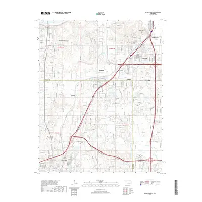
2018 Map of Sapulpa North
USGS Topo · Published 2018About this map
Sapulpa and Sand Springs anchor this landscape along the border of Tulsa and Creek Counties. The area is defined by a dense network of residential streets and industrial corridors, particularly where the St Louis - San Francisco railroad lines cross the terrain. The map captures the suburban and industrial expansion between the major hubs of Tulsa and Sapulpa, showing established neighborhoods like Prattville, Oakhurst, and Red Fork. Genealogists will find several notable burial sites preserved here, including the (Old) Sapulpa Cem and Little Ca Sita Cem. The geography is shaped by the winding paths of Polecat Creek and Nickel Cr, with several man-made reservoirs like Fair Oil Company Lake indicating the region's long history of resource management and industrial use.
Find a feature on this map
206 named features on this map. Tap any name to fly to it.
Don’t see what you’re looking for? This feature index may not catch every label — zoom into the map to look around manually.
Map Details
Editions of this 2018 Sapulpa North Map
This is the sole edition of this map. No revisions or reprints were ever made.
Other maps of this area

1896 · Okmulgee
USGS Topo · 1:125,000

1900 · Okmulgee
USGS Topo · 1:125,000

1901 · Claremore
USGS Topo · 1:125,000

1901 · Nuyaka
USGS Topo · 1:125,000

1912 · Hominy
USGS Topo · 1:125,000

1914 · Kiefer
USGS Topo · 1:62,500

1914 · Claremore
USGS Topo · 1:125,000

1915 · Hominy
USGS Topo · 1:125,000

1916 · Kiefer
USGS Topo · 1:62,500

1916 · Claremore
USGS Topo · 1:125,000