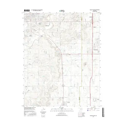
2016 Map of Sapulpa South
USGS Topo · Published 2016About this map
Sapulpa serves as the northern anchor of this survey, where the historic Chief Sapulpa Burying Ground reflects the area's deep roots and namesake heritage. The landscape is defined by the winding course of Polecat Creek and its tributaries, including Childers Creek and Skull Creek, which cut through the undulating terrain south toward Mounds. This region, straddling the Creek and Tulsa County line, exhibits a blend of expanding residential grids in Jenks and Glenpool alongside established rural landmarks like Twin Mounds and the Duckcreek Airport. For genealogists and local historians, the map is remarkably detailed regarding burial sites, identifying numerous locations such as Saint Johns Cemetery and Jimmie Long Cemetery, as well as the open landscape of Picket Prairie. These features collectively reveal the transition from the concentrated urban streets of Watkins to the open water of Lake Jackson.
Find a feature on this map
94 named features on this map. Tap any name to fly to it.
Don’t see what you’re looking for? This feature index may not catch every label — zoom into the map to look around manually.
Map Details
Editions of this 2016 Sapulpa South Map
This is the sole edition of this map. No revisions or reprints were ever made.
Other maps of this area

1896 · Okmulgee
USGS Topo · 1:125,000

1900 · Okmulgee
USGS Topo · 1:125,000

1901 · Claremore
USGS Topo · 1:125,000

1901 · Nuyaka
USGS Topo · 1:125,000

1912 · Hominy
USGS Topo · 1:125,000

1914 · Kiefer
USGS Topo · 1:62,500

1914 · Claremore
USGS Topo · 1:125,000

1915 · Hominy
USGS Topo · 1:125,000

1916 · Kiefer
USGS Topo · 1:62,500

1916 · Claremore
USGS Topo · 1:125,000