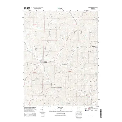
2013 Map of Sarahsville
USGS Topo · Published 2013About this map
Sarahsville and Mount Ephraim anchor this rural Noble County landscape, where the headwaters of N Fork Buffalo Cr and S Fork Buffalo Cr carve through a network of prominent ridges. The map reveals a deeply entrenched pattern of ridge-top settlements and valley-bottom stream crossings, connected by winding routes like Oh-147 and Seneca Lake Rd. For those researching family history, the sheet identifies numerous burial grounds including Old Mt Ephraim Cem, Whigville Cem, and the isolated Archers Ridge Cem. Notable high points like Beatty Knob and High Hill overlook small communities such as Fredericksdale and Whigville, while the southern reaches descend toward E Fork Duck Cr near the hamlet of Duvall.
Find a feature on this map
130 named features on this map. Tap any name to fly to it.
Don’t see what you’re looking for? This feature index may not catch every label — zoom into the map to look around manually.
Map Details
Editions of this 2013 Sarahsville Map
This is the sole edition of this map. No revisions or reprints were ever made.
Other maps of this area

1903 · Macksburg
USGS Topo · 1:62,500

1905 · Macksburg
USGS Topo · 1:62,500

1909 · Caldwell
USGS Topo · 1:62,500

1909 · Summerfield
USGS Topo · 1:62,500

1911 · Cumberland
USGS Topo · 1:62,500

1911 · Summerfield
USGS Topo · 1:62,500

1912 · Caldwell
USGS Topo · 1:62,500

1949 · Clarksburg
USGS Topo · 1:250,000

1956 · Clarksburg
USGS Topo · 1:250,000

1961 · Clarksburg
USGS Topo · 1:250,000