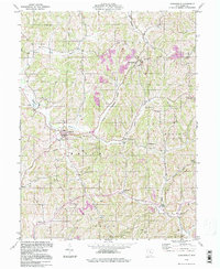
1994 Map of Sarahsville
USGS Topo · Published 1998About this map
The rolling landscape of Noble County is defined by the convergence of several waterways, most notably the North Fork Buffalo Creek and the South Fork Buffalo Creek. These valley corridors served as the primary conduits for local settlement, with villages like Sarahsville and Fredericksdale established along the drainage paths. The area's mid-century economic character is marked by numerous Strip Mines and a pipeline corridor, contrasting with the traditional rural network of churches and ridge-top roads.
Find a feature on this map
36 named features on this map. Tap any name to fly to it.
Don’t see what you’re looking for? This feature index may not catch every label — zoom into the map to look around manually.
Map Details
Editions of this 1994 Sarahsville Map
This is the sole edition of this map. No revisions or reprints were ever made.
Other maps of this area

1903 · Macksburg
USGS Topo · 1:62,500

1905 · Macksburg
USGS Topo · 1:62,500

1909 · Caldwell
USGS Topo · 1:62,500

1909 · Summerfield
USGS Topo · 1:62,500

1911 · Cumberland
USGS Topo · 1:62,500

1911 · Summerfield
USGS Topo · 1:62,500

1912 · Caldwell
USGS Topo · 1:62,500

1949 · Clarksburg
USGS Topo · 1:250,000

1956 · Clarksburg
USGS Topo · 1:250,000

1961 · Clarksburg
USGS Topo · 1:250,000