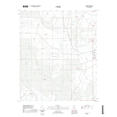
2018 Map of Saranac
USGS Topo · Published 2018About this map
The town of Newellton and the smaller community of Saranac define the eastern and southern boundaries of this Tensas Parish landscape. The terrain is characterized by a complex network of waterways, where names like Cypress Bayou, Becks Bayou, and Routh Bayou reflect the winding alluvial drainage patterns typical of the Mississippi River delta. Natural features like Newells Ridge provide subtle elevation among these wetlands, while Long Lake and Brushy Lake sit as quiet landmarks in the flat bottomlands.
Find a feature on this map
43 named features on this map. Tap any name to fly to it.
Don’t see what you’re looking for? This feature index may not catch every label — zoom into the map to look around manually.
Map Details
Editions of this 2018 Saranac Map
This is the sole edition of this map. No revisions or reprints were ever made.
Other maps of this area

1909 · Delta Bridge
USGS Topo · 1:24,000

1909 · Lake Bruen
USGS Topo · 1:24,000

1935 · Shackleford Lake
USGS Topo · 1:62,500

1939 · Lorman
USGS Topo · 1:62,500

1939 · Locust Ridge
USGS Topo · 1:62,500

1953 · Natchez
USGS Topo · 1:250,000

1955 · Jackson
USGS Topo · 1:250,000

1956 · Natchez
USGS Topo · 1:250,000

1958 · Shackleford Lake
USGS Topo · 1:62,500

1958 · St. Joseph
USGS Topo · 1:62,500