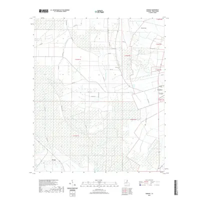
2020 Map of Saranac
USGS Topo · Published 2020About this map
The agricultural landscape of Tensas Parish is defined by a dense network of bayous and sloughs that weave through the lowlands west of the Mississippi River. The town of Newellton serves as the primary hub, situated near the elevated terrain of Newells Ridge. This 2020 survey illustrates how the local economy continues to rely on the fertile alluvial plain, evidenced by features like the Delta Dusters, LLC Airport which supports aerial crop dusting. Away from the main settlements, the land is etched with historical drainage patterns and seasonal water bodies such as Long Lake, Brushy Lake, and Palmetto Slough. Smaller communities and rural junctions like Saranac are connected by a grid of parish roads, while the Newell Cem offers a point of interest for genealogists tracing family histories in this corner of the Mississippi Delta.
Find a feature on this map
42 named features on this map. Tap any name to fly to it.
Don’t see what you’re looking for? This feature index may not catch every label — zoom into the map to look around manually.
Map Details
Editions of this 2020 Saranac Map
This is the sole edition of this map. No revisions or reprints were ever made.
Other maps of this area

1909 · Delta Bridge
USGS Topo · 1:24,000

1909 · Lake Bruen
USGS Topo · 1:24,000

1935 · Shackleford Lake
USGS Topo · 1:62,500

1939 · Lorman
USGS Topo · 1:62,500

1939 · Locust Ridge
USGS Topo · 1:62,500

1953 · Natchez
USGS Topo · 1:250,000

1955 · Jackson
USGS Topo · 1:250,000

1956 · Natchez
USGS Topo · 1:250,000

1958 · Shackleford Lake
USGS Topo · 1:62,500

1958 · St. Joseph
USGS Topo · 1:62,500