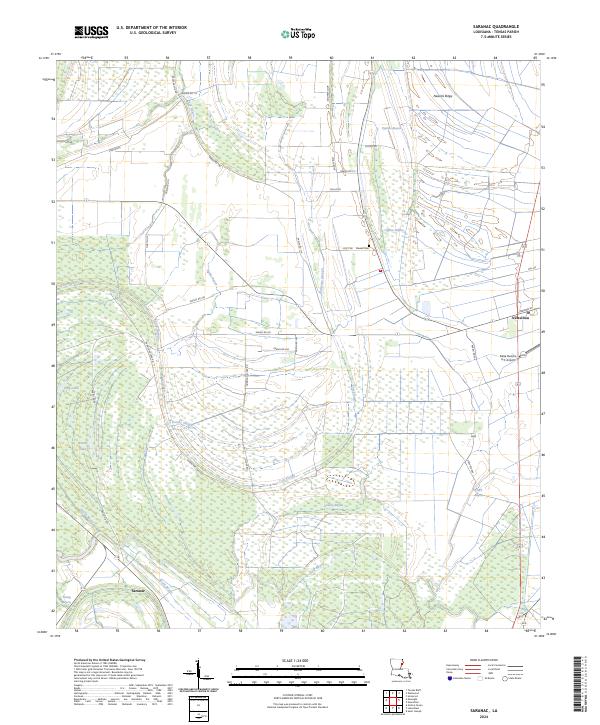
2024 Map of Saranac
USGS Topo · Published 2024About this map
Newellton and the smaller settlement of Saranac sit within a landscape defined by the intricate hydrology of the Tensas Parish lowlands. The area is characterized by a complex network of waterways, including Routh Bayou, Cypress Bayou, and Noble Bayou, which wind through the township grids of t13n r12e and t12n r11e. Higher ground is found along Newells Ridge, where the Newell Cem is located, reflecting the historical pattern of placing cemeteries and homesites on the elevated natural levees to avoid the frequent inundation of the surrounding sloughs and lakes.
Find a feature on this map
41 named features on this map. Tap any name to fly to it.
Don’t see what you’re looking for? This feature index may not catch every label — zoom into the map to look around manually.
Map Details
Editions of this 2024 Saranac Map
This is the sole edition of this map. No revisions or reprints were ever made.
Other maps of this area

1909 · Delta Bridge
USGS Topo · 1:24,000

1909 · Lake Bruen
USGS Topo · 1:24,000

1935 · Shackleford Lake
USGS Topo · 1:62,500

1939 · Lorman
USGS Topo · 1:62,500

1939 · Locust Ridge
USGS Topo · 1:62,500

1953 · Natchez
USGS Topo · 1:250,000

1955 · Jackson
USGS Topo · 1:250,000

1956 · Natchez
USGS Topo · 1:250,000

1958 · Shackleford Lake
USGS Topo · 1:62,500

1958 · St. Joseph
USGS Topo · 1:62,500