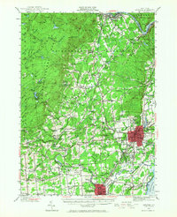
1947 Map of Saratoga
USGS Topo · Published 1968About this map
The Adirondack Mountains and Adirondack Park dominate the northwestern landscape of this mid-century survey, where the Hudson River carves a path through the Luzerne Mts near Spier Falls. The map captures a high concentration of recreational and institutional landmarks, including the famed Saratoga Race Track, Saratoga Raceway, and the Yaddo estate. Further west, the terrain shifts from the developed streets around Skidmore College to the wooded heights near Mount McGregor.
Find a feature on this map
149 named features on this map. Tap any name to fly to it.
Don’t see what you’re looking for? This feature index may not catch every label — zoom into the map to look around manually.
Map Details
Editions of this 1947 Saratoga Map
3 editions found
Other maps of this area

1893 · Cohoes
USGS Topo · 1:62,500

1893 · Schenectady
USGS Topo · 1:62,500

1895 · Cohoes
USGS Topo · 1:62,500

1895 · Schenectady
USGS Topo · 1:62,500

1895 · Amsterdam
USGS Topo · 1:62,500

1895 · Glens Falls
USGS Topo · 1:62,500

1897 · Glens Falls
USGS Topo · 1:62,500

1898 · Schenectady
USGS Topo · 1:62,500

1898 · Cohoes
USGS Topo · 1:62,500

1899 · Broadalbin
USGS Topo · 1:62,500