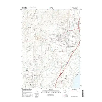
2016 Map of Saratoga Springs
USGS Topo · Published 2016About this map
Saratoga Springs and its surrounding upstate New York landscape are documented here in a modern era of established academic institutions and residential expansion. The map details the core of the city, including the expansive Skidmore College campus and the historic Yaddo estate, alongside the SUNY Empire State Coll. To the south and west, the terrain transitions into the village of Ballston Spa and the smaller settlements of North Ballston Spa and Factory Village.
Find a feature on this map
63 named features on this map. Tap any name to fly to it.
Don’t see what you’re looking for? This feature index may not catch every label — zoom into the map to look around manually.
Map Details
Editions of this 2016 Saratoga Springs Map
This is the sole edition of this map. No revisions or reprints were ever made.
Other maps of this area

1893 · Cohoes
USGS Topo · 1:62,500

1893 · Schenectady
USGS Topo · 1:62,500

1895 · Cohoes
USGS Topo · 1:62,500

1895 · Schenectady
USGS Topo · 1:62,500

1898 · Schenectady
USGS Topo · 1:62,500

1898 · Cohoes
USGS Topo · 1:62,500

1900 · Schuylerville
USGS Topo · 1:62,500

1902 · Saratoga
USGS Topo · 1:62,500

1929 · Cohoes
USGS Topo · 1:62,500

1930 · Schenectady
USGS Topo · 1:62,500