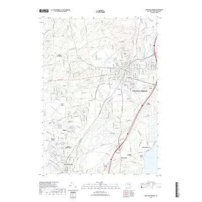
2019 Map of Saratoga Springs
USGS Topo · Published 2019About this map
Saratoga Springs and its southern neighbor Ballston Spa anchor this map of New York's famous spa country. The landscape is defined by the thermal history of the region, marked by Old Red Spring and High Rock Spring, and the sprawling grounds of Skidmore College. To the east, the historic artist retreat Yaddo sits near the marshy edges of Bear Swamp, while to the south, the settlement of Malta Ridge overlooks the western shores of Saratoga Lake. The hydrological network is dominated by the winding course of Kayaderosseras Creek, which feeds into the lake after passing through the heart of the village. Several notable burial grounds, including Greenridge Cem and Saint Peter's Cem, provide significant records for genealogical research. The map also captures the industrial and agricultural character of surrounding communities like Factory Village and South Greenfield, showing a mix of established residential blocks and the open space of the Saratoga County Airport.
Find a feature on this map
257 named features on this map. Tap any name to fly to it.
Don’t see what you’re looking for? This feature index may not catch every label — zoom into the map to look around manually.
Map Details
Editions of this 2019 Saratoga Springs Map
This is the sole edition of this map. No revisions or reprints were ever made.
Other maps of this area

1893 · Cohoes
USGS Topo · 1:62,500

1893 · Schenectady
USGS Topo · 1:62,500

1895 · Cohoes
USGS Topo · 1:62,500

1895 · Schenectady
USGS Topo · 1:62,500

1898 · Schenectady
USGS Topo · 1:62,500

1898 · Cohoes
USGS Topo · 1:62,500

1900 · Schuylerville
USGS Topo · 1:62,500

1902 · Saratoga
USGS Topo · 1:62,500

1929 · Cohoes
USGS Topo · 1:62,500

1930 · Schenectady
USGS Topo · 1:62,500