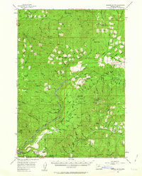
1956 Map of Sardine Butte
USGS Topo · Published 1963About this map
Willamette National Forest dominates this mid-century survey, showcasing a landscape of timber management and mountain infrastructure in Lane County. The Southern Pacific RR snakes along the river corridor, serving the mill town of Westfir and the adjacent Willamette City. This era of forest administration is marked by a network of specialized outposts, including the Martie Creek Guard Station, Flat Creek Guard Sta, and several remote shelters like Delp Creek Shelter and Stag Shelter. High-altitude surveillance points such as Gold Point Lookout and Huckleberry Mtn Lookout emphasize the region's focus on fire detection.
Find a feature on this map
149 named features on this map. Tap any name to fly to it.
Don’t see what you’re looking for? This feature index may not catch every label — zoom into the map to look around manually.
Map Details
Editions of this 1956 Sardine Butte Map
2 editions found

Other maps of this area

1925 · Waldo Lake
USGS Topo · 1:125,000

1934 · Mc Kenzie Bridge
USGS Topo · 1:96,000

1935 · Lowell
USGS Topo · 1:96,000

1940 · Mc Kenzie Bridge
USGS Topo · 1:125,000

1942 · Lowell
USGS Topo · 1:125,000

1951 · Leaburg
USGS Topo · 1:62,500

1953 · Salem
USGS Topo · 1:250,000

1954 · Salem
USGS Topo · 1:250,000

1955 · Hardesty Mtn
USGS Topo · 1:62,500

1955 · Fairview Peak
USGS Topo · 1:62,500