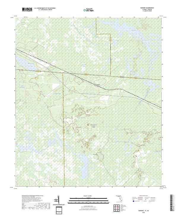
2024 Map of Sargent
USGS Topo · Published 2024About this map
Okefenokee Swamp dominates this landscape along the Georgia-Florida border, a complex ecosystem of wetlands and islands. The northern portion is heavily defined by the protected acreage of the Okefenokee Wilderness and Okefenokee National Wildlife Refuge, where features like Sapp Prairie and White Arm Bay mark the transition from water to timberland. The small settlement of Sargent sits at a geographic crossroads near several county lines, including the junction of Clinch, Ware, Columbia, and Baker counties.
Find a feature on this map
27 named features on this map. Tap any name to fly to it.
Don’t see what you’re looking for? This feature index may not catch every label — zoom into the map to look around manually.
Map Details
Editions of this 2024 Sargent Map
This is the sole edition of this map. No revisions or reprints were ever made.
Other maps of this area

1954 · Valdosta
USGS Topo · 1:250,000

1955 · Council
USGS Topo · 1:24,000

1956 · Eddy
USGS Topo · 1:24,000

1956 · Sargent
USGS Topo · 1:24,000

1958 · Valdosta
USGS Topo · 1:250,000

1959 · Valdosta
USGS Topo · 1:250,000

1965 · Blackjack Island
USGS Topo · 1:24,000

1967 · Strange Island
USGS Topo · 1:24,000

1967 · Sargent
USGS Topo · 1:24,000
1967 · Eddy
USGS Topo · 1:24,000