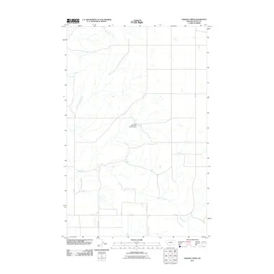
2011 Map of Sargent Creek
USGS Topo · Published 2011About this map
Sargent Creek meanders through this landscape in the Frazer District of Valley County, defining the drainage patterns of this rural Montana territory. The area is characterized by open ranchland and a sparse network of county roads including Geer Rd, Phillip Rd, and the uniquely named Dead Lamb Rd. An important water management feature, the Fort Peck Reservation Number 4 Dam, stands as a primary landmark in this section of the state. The layout of the roads and watercourses reveals the practical infrastructure required for land management and agriculture in this corner of Montana, where Rte-438 provides a primary route through the eastern portion of the quadrangle. This 2011 survey captures the area at a time when traditional land use remains the cornerstone of the local geography.
Find a feature on this map
6 named features on this map. Tap any name to fly to it.
Don’t see what you’re looking for? This feature index may not catch every label — zoom into the map to look around manually.
Map Details
Editions of this 2011 Sargent Creek Map
This is the sole edition of this map. No revisions or reprints were ever made.
Other maps of this area

1914 · Nashua
USGS Topo · 1:62,500

1915 · Frazer
USGS Topo · 1:62,500

1915 · Spring Creek
USGS Topo · 1:62,500

1916 · Nashua
USGS Topo · 1:62,500

1918 · Porcupine Valley
USGS Topo · 1:62,500

1954 · Glasgow
USGS Topo · 1:250,000

1957 · Glasgow
USGS Topo · 1:250,000

1958 · Glasgow
USGS Topo · 1:250,000
1972 · Milk River Coulee
USGS Topo · 1:24,000
1972 · Lindeke Coulee
USGS Topo · 1:24,000