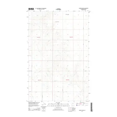
2014 Map of Sargent Creek
USGS Topo · Published 2014About this map
Sargent Cr snakes through this high plains landscape in Valley County, creating a drainage network that defines the local topography. The area is marked by significant natural depressions including Bonnies Coulee and Johnson Coulee, which serve as primary features in an otherwise expansive terrain. This 2014 survey reveals a sparse but established grid of rural access routes, including Sargent Creek Rd and Geer Rd, which likely support the ranching operations suggested by local landmarks like B Bar H Ln. The naming of minor thoroughfares such as Dead Lamb Rd and Phillippi Rd provides a specific cultural imprint on the landscape, reflecting the ranching heritage and local history of the Frazer District near the border of townships t30n r41e and t30n r42e.
Find a feature on this map
15 named features on this map. Tap any name to fly to it.
Don’t see what you’re looking for? This feature index may not catch every label — zoom into the map to look around manually.
Map Details
Editions of this 2014 Sargent Creek Map
This is the sole edition of this map. No revisions or reprints were ever made.
Other maps of this area

1914 · Nashua
USGS Topo · 1:62,500

1915 · Frazer
USGS Topo · 1:62,500

1915 · Spring Creek
USGS Topo · 1:62,500

1916 · Nashua
USGS Topo · 1:62,500

1918 · Porcupine Valley
USGS Topo · 1:62,500

1954 · Glasgow
USGS Topo · 1:250,000

1957 · Glasgow
USGS Topo · 1:250,000

1958 · Glasgow
USGS Topo · 1:250,000
1972 · Milk River Coulee
USGS Topo · 1:24,000
1972 · Lindeke Coulee
USGS Topo · 1:24,000