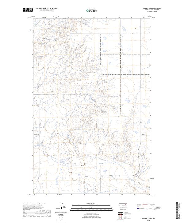
2024 Map of Sargent Creek
USGS Topo · Published 2024About this map
Sargent Creek winds through the heart of this Valley County landscape, defining the local drainage and topography in a region marked by extensive township and range surveying. The terrain is characterized by intricate drainage patterns such as Johnson Coulee, which cuts through the high plains. A network of rural routes and gravel roads, including Geer Rd and Phillipi Rd, connects remote ranching areas and agricultural land. The presence of Old Airport Tower Rd in the northwestern corner suggests a history of localized aviation or utility infrastructure that once served this portion of the Montana plains. This modern survey provides a detailed view of the contemporary road network, including Rte 438 and Brandt Rd, reflecting the current land management and transportation layout of the Missouri River country.
Find a feature on this map
13 named features on this map. Tap any name to fly to it.
Don’t see what you’re looking for? This feature index may not catch every label — zoom into the map to look around manually.
Map Details
Editions of this 2024 Sargent Creek Map
This is the sole edition of this map. No revisions or reprints were ever made.
Other maps of this area

1914 · Nashua
USGS Topo · 1:62,500

1915 · Frazer
USGS Topo · 1:62,500

1915 · Spring Creek
USGS Topo · 1:62,500

1916 · Nashua
USGS Topo · 1:62,500

1918 · Porcupine Valley
USGS Topo · 1:62,500

1954 · Glasgow
USGS Topo · 1:250,000

1957 · Glasgow
USGS Topo · 1:250,000

1958 · Glasgow
USGS Topo · 1:250,000
1972 · Milk River Coulee
USGS Topo · 1:24,000
1972 · Lindeke Coulee
USGS Topo · 1:24,000