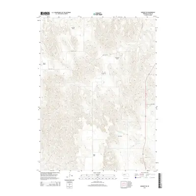
2014 Map of Sargent SW
USGS Topo · Published 2014About this map
Somerford Cem sits centrally within this landscape of Custer County, marking a focal point for genealogy in a region defined by dramatic topographic relief and high plateaus. The western portion of the map is dominated by Boggs Table, an elevated landform that rises above the surrounding drainages. Erosion and geological time have carved out several distinct lowlands, including Antelope Valley in the north and the namesake Round Valley to the west. These natural corridors dictated early travel and settlement patterns, with Somerford Valley and Dry Valley providing structured paths through the terrain. Water is sparse here, primarily represented by the intermittent flow of Wagner Cr. Modern infrastructure follows these older geographic cues, as seen where Us-183 and the NE-21C Spur navigate the valleys to the east, while Round Valley Rd connects the disparate western valleys across the high ground.
Find a feature on this map
10 named features on this map. Tap any name to fly to it.
Don’t see what you’re looking for? This feature index may not catch every label — zoom into the map to look around manually.
Map Details
Editions of this 2014 Sargent SW Map
This is the sole edition of this map. No revisions or reprints were ever made.
Other maps of this area

1951 · Broken Bow NE
USGS Topo · 1:24,000

1951 · Westerville
USGS Topo · 1:24,000

1951 · Ansley NE
USGS Topo · 1:24,000

1951 · Walworth
USGS Topo · 1:24,000

1951 · Round Valley
USGS Topo · 1:24,000

1952 · Sargent East
USGS Topo · 1:24,000

1952 · Sargent SE
USGS Topo · 1:24,000

1952 · Sargent West
USGS Topo · 1:24,000

1952 · Sargent SW
USGS Topo · 1:24,000

1955 · Broken Bow
USGS Topo · 1:250,000