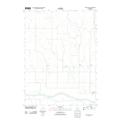
2011 Map of Sargent West
USGS Topo · Published 2011About this map
The Middle Loup River meanders across the southern portion of this landscape, anchoring the settlement of Sargent in Custer County. The map documents a rural Nebraska community defined by its waterways and agricultural road network, including Victoria Springs Rd and Round Valley Rd. Three local burial sites—West Union Cemetery, Saint Marys Cemetery, and Mount Hope Cemetery—are clearly identified, providing essential location data for genealogists and local historians. North of the river, the terrain is shaped by Sand Canyon and the drainages of Sand Creek and Spring Creek, illustrating the natural irrigation patterns of the Great Plains. The grid-like precision of the section lines contrasts with the fluid paths of the creeks, showing how 21st-century land management overlays the native geography.
Find a feature on this map
13 named features on this map. Tap any name to fly to it.
Don’t see what you’re looking for? This feature index may not catch every label — zoom into the map to look around manually.
Map Details
Editions of this 2011 Sargent West Map
This is the sole edition of this map. No revisions or reprints were ever made.
Other maps of this area

1951 · Walworth
USGS Topo · 1:24,000

1951 · Round Valley
USGS Topo · 1:24,000

1952 · Sargent East
USGS Topo · 1:24,000

1952 · Sargent SE
USGS Topo · 1:24,000

1952 · Sargent West
USGS Topo · 1:24,000

1952 · Taylor SE
USGS Topo · 1:24,000

1952 · Sargent SW
USGS Topo · 1:24,000

1952 · Almeria
USGS Topo · 1:24,000

1952 · Taylor
USGS Topo · 1:24,000

1955 · Broken Bow
USGS Topo · 1:250,000