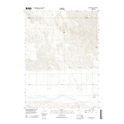
2014 Map of Sargent West
USGS Topo · Published 2014About this map
The Middle Loup River valley dominates this portion of Custer County, shaping the local geography as it flows through the southern reaches of the area near the town of Sargent. To the north, the terrain becomes increasingly dissected by deep drainage features like Chesbra Canyon and Leydell Canyon, which cut through the high plains. This map provides a detailed view of the rural landscape in the 2010s, where traditional county life is anchored by a series of local landmarks. Genealogists will find the locations of several burial grounds, including West Union Cem, Saint Marys Cem, and Mt Hope Cem, which are situated along the transition from the river bottom to the higher canyon country. The area's hydrology is further defined by ephemeral and perennial flows such as Sand Cr and Spring Cr, which drain the intricate canyon systems into the river basin below.
Find a feature on this map
19 named features on this map. Tap any name to fly to it.
Don’t see what you’re looking for? This feature index may not catch every label — zoom into the map to look around manually.
Map Details
Editions of this 2014 Sargent West Map
This is the sole edition of this map. No revisions or reprints were ever made.
Other maps of this area

1951 · Walworth
USGS Topo · 1:24,000

1951 · Round Valley
USGS Topo · 1:24,000

1952 · Sargent East
USGS Topo · 1:24,000

1952 · Sargent SE
USGS Topo · 1:24,000

1952 · Sargent West
USGS Topo · 1:24,000

1952 · Taylor SE
USGS Topo · 1:24,000

1952 · Sargent SW
USGS Topo · 1:24,000

1952 · Almeria
USGS Topo · 1:24,000

1952 · Taylor
USGS Topo · 1:24,000

1955 · Broken Bow
USGS Topo · 1:250,000