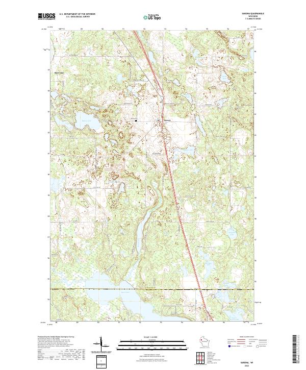
2022 Map of Sarona
USGS Topo · Published 2022About this map
Sarona serves as the central hub of this northern Wisconsin landscape, situated along the Wild Rivers State Trl as it cuts north through the timber and wetlands of southern Washburn County. The map reveals a dense glaciated terrain defined by numerous small basins and larger water bodies like Bear Lake and Ripley Lake. Historical local infrastructure is evident at the Sarona Cem, while the intricate network of rural roads such as Kagama Rd and Shelton Tower Rd provides access to the scattered residences and farms that characterize the region. The southern edge of the survey transitions across the Barron County line, where the headwaters of Sucker Cr and Boyer Creek originate. This detailed 2022 survey documents a landscape where modern recreation trails follow historic transit corridors, maintaining the quiet, rural character established by early 20th-century settlers.
Find a feature on this map
65 named features on this map. Tap any name to fly to it.
Don’t see what you’re looking for? This feature index may not catch every label — zoom into the map to look around manually.
Map Details
Editions of this 2022 Sarona Map
This is the sole edition of this map. No revisions or reprints were ever made.
Other maps of this area

1948 · Spooner
USGS Topo · 1:48,000

1948 · Stone Lake
USGS Topo · 1:48,000

1949 · Spooner
USGS Topo · 1:48,000

1949 · Rice Lake
USGS Topo · 1:48,000

1950 · Stone Lake
USGS Topo · 1:48,000

1951 · Shell Lake
USGS Topo · 1:48,000

1951 · Rice Lake
USGS Topo · 1:48,000

1953 · Rice Lake
USGS Topo · 1:250,000

1959 · Rice Lake
USGS Topo · 1:250,000

1965 · Rice Lake
USGS Topo · 1:62,500