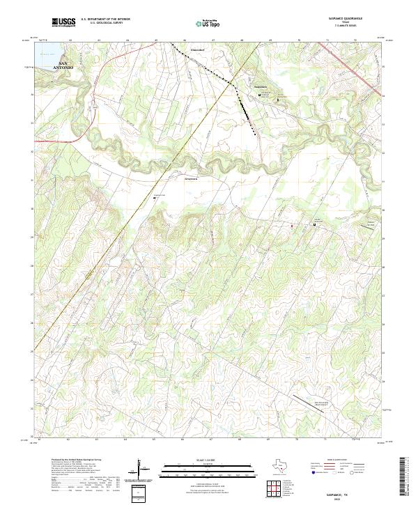
2022 Map of Saspamco
USGS Topo · Published 2022About this map
The winding San Antonio River carves a deep path through this south Texas landscape, defining the boundary between Bexar and Wilson counties. The settlement of Saspamco, named for the San Antonio Sewer Pipe Manufacturing Company, sits just north of the river, while Graytown and Elmendorf anchor the nearby agricultural and ranching corridors. These communities are deeply rooted, as evidenced by several significant burial sites including the Canada Verde Cem, Our Lady of Perpetual Help Cem, and the De Los Santos Cem.
Find a feature on this map
71 named features on this map. Tap any name to fly to it.
Don’t see what you’re looking for? This feature index may not catch every label — zoom into the map to look around manually.
Map Details
Editions of this 2022 Saspamco Map
This is the sole edition of this map. No revisions or reprints were ever made.
Other maps of this area

1936 · Floresville
USGS Topo · 1:62,500

1953 · Elmendorf
USGS Topo · 1:24,000

1953 · Southton
USGS Topo · 1:24,000

1954 · San Antonio
USGS Topo · 1:250,000

1957 · San Antonio
USGS Topo · 1:250,000

1958 · Losoya
USGS Topo · 1:24,000

1958 · La Vernia SW
USGS Topo · 1:24,000

1958 · Saspamco
USGS Topo · 1:24,000
1961 · Dewees
USGS Topo · 1:24,000
1961 · Floresville
USGS Topo · 1:24,000