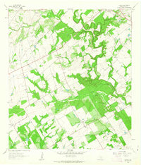
1961 Map of Dewees
USGS Topo · Published 1963About this map
The San Antonio River snakes through this 1961 portrait of Wilson County, carving a heavily wooded riparian corridor through the ranchlands. A significant point of local history is the Mission of Las Cabreras (Ruins), situated near the riverbanks, representing the deep colonial roots of the region. The map highlights a series of family-named settlements and working estates, including Dewees Ranch, Connally Ranch, and Camp Ranch, which suggest a landscape dominated by large-scale cattle operations and rural homesteads.
Find a feature on this map
21 named features on this map. Tap any name to fly to it.
Don’t see what you’re looking for? This feature index may not catch every label — zoom into the map to look around manually.
Map Details
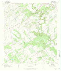
Editions of this 1961 Dewees Map
2 editions found
Other maps of this area

1925 · Tordia No. 1
USGS Topo · 1:48,000

1931 · Falls City
USGS Topo · 1:62,500

1936 · Floresville
USGS Topo · 1:62,500

1953 · Crystal City
USGS Topo · 1:250,000

1954 · San Antonio
USGS Topo · 1:250,000

1955 · Crystal City
USGS Topo · 1:250,000

1956 · Pleasanton
USGS Topo · 1:62,500

1957 · San Antonio
USGS Topo · 1:250,000

1958 · Saspamco
USGS Topo · 1:24,000

1961 · Crystal City
USGS Topo · 1:250,000