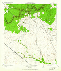
1916 Map of Satsuma
USGS Topo · Published 1961About this map
Sawmills and early railroad infrastructure dominate this northwest Harris County landscape during the first decades of the twentieth century. The presence of Christy Sawmill, Anderson Sawmill, and Wrothe Sawmill suggests a rural economy still heavily tied to timber and local milling. Settlement is concentrated along primary transportation corridors, with Satsuma and North Houston serving as key nodes for the Southern Pacific System and the Trinity and Brazos Valley railroads. The map captures a transition from wooded gullies near Faulkey Gully and Pillot Gully to the open prairie land that would later define the Houston suburbs. Waterways like Whiteoak Bayou and Greens Bayou provide the natural drainage for the region, while the Fuchs School and family-named roads like Jack Rabbit Road offer specific points of interest for genealogists and local historians.
Find a feature on this map
20 named features on this map. Tap any name to fly to it.
Don’t see what you’re looking for? This feature index may not catch every label — zoom into the map to look around manually.
Map Details
Editions of this 1916 Satsuma Map
3 editions found
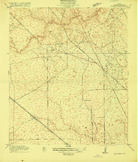
Other maps of this area

1915 · Houston Heights
USGS Topo · 1:24,000

1915 · Cypress
USGS Topo · 1:24,000

1915 · Addicks
USGS Topo · 1:24,000

1915 · Hillendahl
USGS Topo · 1:24,000

1916 · Rose Hill
USGS Topo · 1:24,000

1916 · Aldine
USGS Topo · 1:24,000

1916 · Louetta
USGS Topo · 1:24,000

1916 · Satsuma
USGS Topo · 1:24,000

1916 · Spring
USGS Topo · 1:24,000

1918 · Cypress
USGS Topo · 1:31,680