1920 Map of Satsuma
USGS Topo · Published 1920About this map
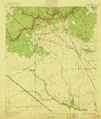
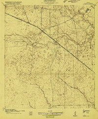
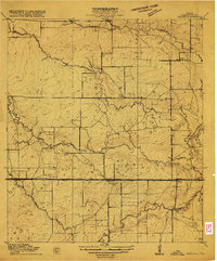
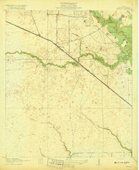
Cypress Creek and its complex of drainage gullies define the northern reaches of this Harris County landscape, which in the late 1910s remained a largely rural expanse of bayous and scattered sawmills. The local economy is anchored by timber processing, visible at the Christy Sawmill, Anderson Sawmill, and Wrothe Sawmill, all positioned near the creek and its tributaries. Education in this agrarian community centers on the Fuchs School, while small settlements like Satsuma and North Houston serve as points of trade along an emerging transportation network.
Find a feature on this map
23 named features on this map. Tap any name to fly to it.
Don’t see what you’re looking for? This feature index may not catch every label — zoom into the map to look around manually.
Map Details
Editions of this 1920 Satsuma Map
2 editions found

Other maps of this area

1915 · Houston Heights
USGS Topo · 1:24,000
1915 · Cypress
USGS Topo · 1:24,000
1915 · Addicks
USGS Topo · 1:24,000

1915 · Hillendahl
USGS Topo · 1:24,000

1916 · Rose Hill
USGS Topo · 1:24,000

1916 · Aldine
USGS Topo · 1:24,000

1916 · Louetta
USGS Topo · 1:24,000

1916 · Satsuma
USGS Topo · 1:24,000

1916 · Spring
USGS Topo · 1:24,000
1918 · Cypress
USGS Topo · 1:31,680