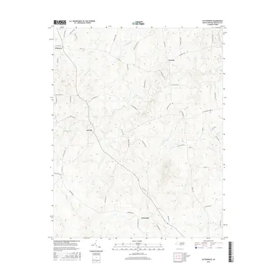
2016 Map of Satterwhite
USGS Topo · Published 2016About this map
Cornwall and Satterwhite anchor this survey of rural Granville County, where a network of family-named roads and winding waterways defines the landscape. The terrain is deeply carved by drainage systems including Little Johnson Cr in the north and the extensive reach of Mountain Cr through the center. Small settlements like Oak Hill and Wilbourns are situated along ridge lines, connected by historical thoroughfares such as Cornwall Rd and Oak Hill Rd. Genealogists and local historians will find numerous landmarks bearing local surnames, from Gregory Lake to Smyrna Br. The map captures a transition between traditional agricultural layouts and modern road classifications, preserving the locations of rural homesteads and junctions that have served as community hubs for generations in this part of North Carolina.
Find a feature on this map
57 named features on this map. Tap any name to fly to it.
Don’t see what you’re looking for? This feature index may not catch every label — zoom into the map to look around manually.
Map Details
Editions of this 2016 Satterwhite Map
This is the sole edition of this map. No revisions or reprints were ever made.
Other maps of this area

1941 · Clarksville
USGS Topo · 1:48,000

1943 · Clarksville
USGS Topo · 1:62,500

1943 · Roxboro
USGS Topo · 1:62,500

1953 · Oxford
USGS Topo · 1:62,500

1953 · South Boston
USGS Topo · 1:62,500

1953 · Greensboro
USGS Topo · 1:250,000

1954 · Greensboro
USGS Topo · 1:250,000

1957 · South Boston
USGS Topo · 1:62,500

1957 · Clarksville
USGS Topo · 1:62,500

1962 · Greensboro
USGS Topo · 1:250,000