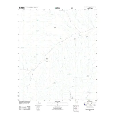
2012 Map of Saucito Mountain
USGS Topo · Published 2012About this map
K X Ranch and Santa Lucia Ranch define the ranching landscape of this Pima County region, where water management is central to the local geography. The area is characterized by a complex network of seasonal drainage systems, most notably Sopori Wash and Batamote Wash, which cut through the arid terrain. Cattle ranching infrastructure is evident through numerous named water catchments such as Sparkplug Tank, Wino Tank, and Suzy Q Tank, supporting operations near Moyza Ranch. The topography rises toward the southeast at Saucito Mountain, while the northern portion is dominated by the broad elevation of Sheriffs Mesa. This 2012 survey illustrates the continued reliance on traditional desert ranching footprints, connected by primitive routes like Moyza Ranch Rd and W Arivaca Rd.
Find a feature on this map
41 named features on this map. Tap any name to fly to it.
Don’t see what you’re looking for? This feature index may not catch every label — zoom into the map to look around manually.
Map Details
Editions of this 2012 Saucito Mountain Map
This is the sole edition of this map. No revisions or reprints were ever made.
Other maps of this area

1920 · Arivaca
USGS Topo · 1:125,000

1925 · Samaniego Peak
USGS Topo · 1:62,500

1939 · Twin Buttes
USGS Topo · 1:62,500

1939 · Tubac
USGS Topo · 1:62,500

1940 · Palo Alto Ranch
USGS Topo · 1:62,500

1941 · Twin Buttes
USGS Topo · 1:62,500

1941 · Arivaca
USGS Topo · 1:62,500

1943 · Arivaca
USGS Topo · 1:62,500

1943 · Palo Alto Ranch
USGS Topo · 1:62,500

1943 · Tubac
USGS Topo · 1:62,500