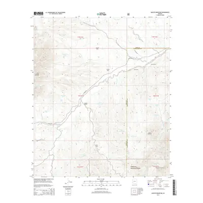
2014 Map of Saucito Mountain
USGS Topo · Published 2014About this map
The Cerro Colorado Mountains and the Tumacacori Mountains frame this high-desert corridor along the border of Pima and Santa Cruz counties. The landscape is defined by an intricate network of ephemeral drainages, such as Batamote Wash and Saucito Wash, which cut through landforms like Sheriffs Mesa and Sardina Canyon. Human presence is marked by the careful management of water, evidenced by a high density of named stock tanks including Bob Brown Tank, Sparkplug Tank, and Suzy Q Tank. These features, along with the southern portion of the Coronado National Forest, illustrate a region dedicated to rangeland and conservation. The path of W Arivaca Rd provides the primary transit through this basin, connecting the isolated watering holes and canyons that have supported local ranching operations for generations.
Find a feature on this map
48 named features on this map. Tap any name to fly to it.
Don’t see what you’re looking for? This feature index may not catch every label — zoom into the map to look around manually.
Map Details
Editions of this 2014 Saucito Mountain Map
This is the sole edition of this map. No revisions or reprints were ever made.
Other maps of this area

1920 · Arivaca
USGS Topo · 1:125,000

1925 · Samaniego Peak
USGS Topo · 1:62,500

1939 · Twin Buttes
USGS Topo · 1:62,500

1939 · Tubac
USGS Topo · 1:62,500

1940 · Palo Alto Ranch
USGS Topo · 1:62,500

1941 · Twin Buttes
USGS Topo · 1:62,500

1941 · Arivaca
USGS Topo · 1:62,500

1943 · Arivaca
USGS Topo · 1:62,500

1943 · Palo Alto Ranch
USGS Topo · 1:62,500

1943 · Tubac
USGS Topo · 1:62,500