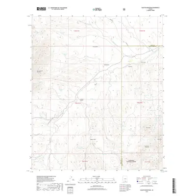
2018 Map of Saucito Mountain
USGS Topo · Published 2018About this map
The Cerro Colorado Mountains define the western landscape of this southern Arizona desert terrain, where the arid environment is managed through an extensive network of named stock tanks and washes. These water features, including Wino Tank, Sparkplug Tank, and Suzy Q Tank, trace the ranching infrastructure established across the Pima and Santa Cruz county lines. The map reveals a land structured by topography and water rights, with the Tumacácori Mountains rising in the southeast and the Saucito Mtn providing a central landmark. Roadways like Batamote Rd and S Moyza Ranch Rd provide access to remote areas within the Coronado National Forest, where the complex drainage systems of Saucito Wash and Sopori Wash carve the basin floor.
Find a feature on this map
51 named features on this map. Tap any name to fly to it.
Don’t see what you’re looking for? This feature index may not catch every label — zoom into the map to look around manually.
Map Details
Editions of this 2018 Saucito Mountain Map
This is the sole edition of this map. No revisions or reprints were ever made.
Other maps of this area

1920 · Arivaca
USGS Topo · 1:125,000

1925 · Samaniego Peak
USGS Topo · 1:62,500

1939 · Twin Buttes
USGS Topo · 1:62,500

1939 · Tubac
USGS Topo · 1:62,500

1940 · Palo Alto Ranch
USGS Topo · 1:62,500

1941 · Twin Buttes
USGS Topo · 1:62,500

1941 · Arivaca
USGS Topo · 1:62,500

1943 · Arivaca
USGS Topo · 1:62,500

1943 · Palo Alto Ranch
USGS Topo · 1:62,500

1943 · Tubac
USGS Topo · 1:62,500