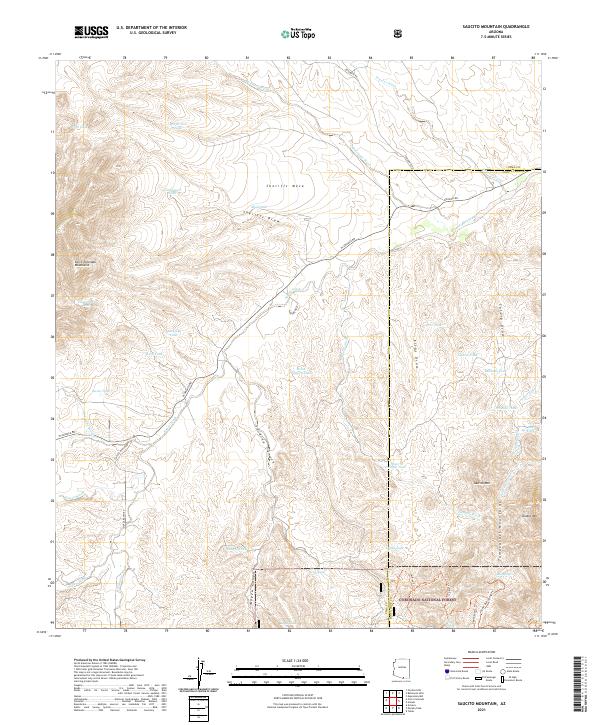
2021 Map of Saucito Mountain
USGS Topo · Published 2021About this map
The Coronado National Forest occupies the southeastern corner of this landscape, where the Tumacacori Mountains rise sharply. The terrain is defined by a series of prominent peaks and canyons, including Saucito Mtn and the steep Sardina Canyon that cuts through the center of the sheet. This area is characterized by an extensive network of water management features, mostly small tanks such as Sparkplug Tank, Horse Pasture Tank, and Suzy Q Tank, which are essential for livestock in this arid environment.
Find a feature on this map
57 named features on this map. Tap any name to fly to it.
Don’t see what you’re looking for? This feature index may not catch every label — zoom into the map to look around manually.
Map Details
Editions of this 2021 Saucito Mountain Map
This is the sole edition of this map. No revisions or reprints were ever made.
Other maps of this area

1920 · Arivaca
USGS Topo · 1:125,000

1925 · Samaniego Peak
USGS Topo · 1:62,500

1939 · Twin Buttes
USGS Topo · 1:62,500

1939 · Tubac
USGS Topo · 1:62,500

1940 · Palo Alto Ranch
USGS Topo · 1:62,500

1941 · Twin Buttes
USGS Topo · 1:62,500

1941 · Arivaca
USGS Topo · 1:62,500

1943 · Arivaca
USGS Topo · 1:62,500

1943 · Palo Alto Ranch
USGS Topo · 1:62,500

1943 · Tubac
USGS Topo · 1:62,500