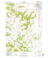
1975 Map of Sauk Prairie
USGS Topo · Published 1978About this map
The Badger Army Ammunition Plant dominates the eastern edge of this landscape, its sprawling grid and industrial footprint served by the U. S. Government Railroad. This 1975 survey shows the facility in the decade following its peak Vietnam War production, set against the traditional dairy and agricultural lands of Sumpter and Troy. The terrain transitions from the heights of the South Range and Dinosaur Bluff down to the fertile flats of the Sauk River valley.
Find a feature on this map
57 named features on this map. Tap any name to fly to it.
Don’t see what you’re looking for? This feature index may not catch every label — zoom into the map to look around manually.
Map Details
Editions of this 1975 Sauk Prairie Map
2 editions found

Other maps of this area

1895 · Baraboo
USGS Topo · 1:62,500

1901 · Denzer
USGS Topo · 1:62,500

1907 · Cross Plains
USGS Topo · 1:62,500

1908 · Baraboo
USGS Topo · 1:62,500

1909 · Cross Plains
USGS Topo · 1:62,500

1920 · Blue Mounds
USGS Topo · 1:62,500

1922 · Blue Mounds
USGS Topo · 1:62,500

1957 · Madison
USGS Topo · 1:250,000

1958 · North Freedom
USGS Topo · 1:62,500

1959 · Baraboo
USGS Topo · 1:62,500