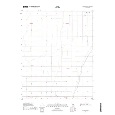
2018 Map of Sausalito School
USGS Topo · Published 2018About this map
The San Joaquin Valley landscape of the Central Valley is defined here by a rigid grid of agricultural roads and essential water infrastructure. The most prominent man-made feature is the Friant-Kern Canal, which cuts diagonally across the eastern portion of the terrain, representing a critical artery for regional irrigation. This engineered waterway contrasts with the meandering path of Deer Creek, which winds westward through the center of the survey area. The map illustrates a highly organized rural infrastructure, dominated by labeled thoroughfares such as Co Hwy J15, Co Hwy J27, and Co Rd J24. This network of avenues and numbered roads, including Avenue 80 Co Rd, reflects the systematic development of Tulare County’s agricultural heartland, where land divisions are precisely managed for large-scale cultivation.
Find a feature on this map
43 named features on this map. Tap any name to fly to it.
Don’t see what you’re looking for? This feature index may not catch every label — zoom into the map to look around manually.
Map Details
Editions of this 2018 Sausalito School Map
This is the sole edition of this map. No revisions or reprints were ever made.
Other maps of this area

1925 · Tipton
USGS Topo · 1:31,680

1928 · Tipton
USGS Topo · 1:31,680

1928 · Woodville
USGS Topo · 1:31,680

1929 · Delano
USGS Topo · 1:31,680

1929 · Sausalito School
USGS Topo · 1:31,680

1929 · Richgrove
USGS Topo · 1:31,680

1929 · Porterville
USGS Topo · 1:31,680

1929 · Pixley
USGS Topo · 1:31,680

1929 · Stone
USGS Topo · 1:31,680

1929 · Ducor
USGS Topo · 1:31,680