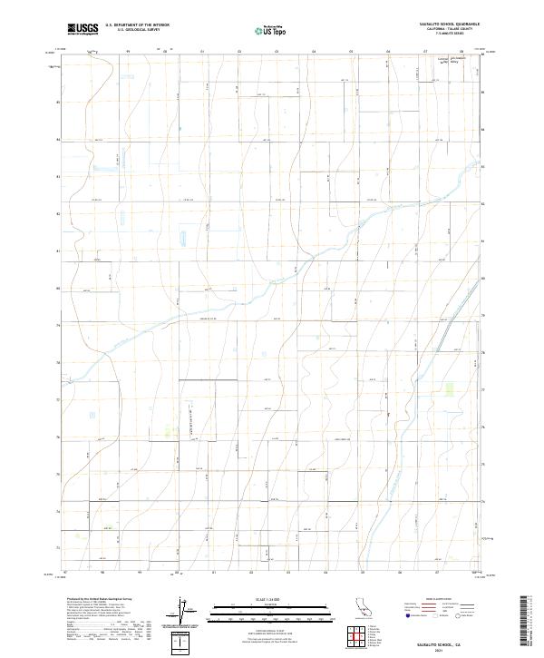
2021 Map of Sausalito School
USGS Topo · Published 2021About this map
The vast agricultural landscape of the San Joaquin Valley is defined by the rigid geometry of irrigation and transport in this 2021 study. Located within the Central Valley of Tulare County, the area is bisected by the massive engineering of the Friant-Kern Canal, which cuts a diagonal path through the gridded section lines. This vital water infrastructure supports the surrounding orchards and fields, contrasting with the natural, meandering course of Deer Creek that winds across the northern and central sections.
Find a feature on this map
41 named features on this map. Tap any name to fly to it.
Don’t see what you’re looking for? This feature index may not catch every label — zoom into the map to look around manually.
Map Details
Editions of this 2021 Sausalito School Map
This is the sole edition of this map. No revisions or reprints were ever made.
Other maps of this area

1925 · Tipton
USGS Topo · 1:31,680

1928 · Tipton
USGS Topo · 1:31,680

1928 · Woodville
USGS Topo · 1:31,680

1929 · Delano
USGS Topo · 1:31,680

1929 · Sausalito School
USGS Topo · 1:31,680

1929 · Richgrove
USGS Topo · 1:31,680

1929 · Porterville
USGS Topo · 1:31,680

1929 · Pixley
USGS Topo · 1:31,680

1929 · Stone
USGS Topo · 1:31,680

1929 · Ducor
USGS Topo · 1:31,680