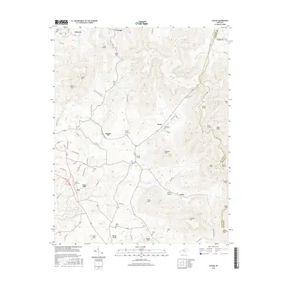
2016 Map of Savage
USGS Topo · Published 2016About this map
Savage and the surrounding highlands of Clinton County define this landscape, where the boundary with Wayne County follows the high ridgelines of the Cumberland Plateau. The area is characterized by numerous small settlements and family landmarks, including Duvall Valley, Jones Mill, and Cannons Mill. A high concentration of community burial grounds and houses of worship, such as Oak Grove Church Cem, Central Grove Church Cem, and Clinton Chapel Cem, points to a long-established rural social structure. The topography is deeply incised by watercourses like Duvall Cr and Koger Cr, creating isolated peaks such as Copperas Knob and Jennys Knob. This network of hollows and ridges, including Denney Hollow and Tuggle Hollow, historically dictated the path of local travel along routes like Old Savage Hill Rd.
Find a feature on this map
85 named features on this map. Tap any name to fly to it.
Don’t see what you’re looking for? This feature index may not catch every label — zoom into the map to look around manually.
Map Details
Editions of this 2016 Savage Map
This is the sole edition of this map. No revisions or reprints were ever made.
Other maps of this area

1911 · Monticello
USGS Topo · 1:62,500

1914 · Monticello
USGS Topo · 1:62,500

1929 · Byrdstown
USGS Topo · 1:62,500

1934 · Pall Mall
USGS Topo · 1:62,500

1953 · Parnell
USGS Topo · 1:24,000

1953 · Wolf Creek Dam
USGS Topo · 1:24,000

1954 · Cumberland City
USGS Topo · 1:24,000

1954 · Albany
USGS Topo · 1:24,000

1954 · Savage
USGS Topo · 1:24,000

1954 · Powersburg
USGS Topo · 1:24,000