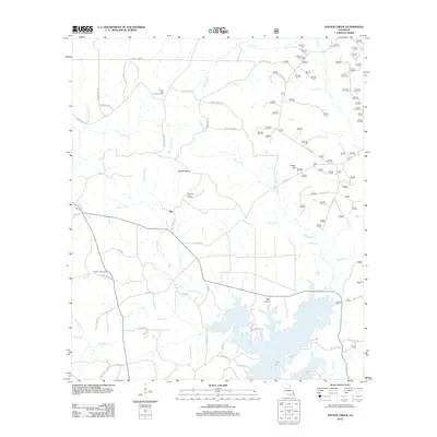
2012 Map of Savage Creek
USGS Topo · Published 2012About this map
Iatt serves as the focal point for this Grant Parish landscape, where the rural settlement pattern is defined by a dense network of named watercourses and mid-century industrial activity. The southern portion of the sheet is dominated by the sprawling waters of Lake Iatt, fed by a complex system of drainage including Savage Cr, Hurley Br, and Parasol Bayou. This 2012 survey illustrates the continued importance of regional extraction, marking the White Oak Creek Oil Field and the Blue Lick Creek Oil Field north of the lake. Local landmarks such as the Verda Lookout Tower and Potato Hill provide vertical relief in an area otherwise characterized by ridges and bottomlands. Genealogists and local historians will find several key cultural sites, including Iatt Church and established burial grounds like French Cemetery and Shady Grove Cemetery.
Find a feature on this map
61 named features on this map. Tap any name to fly to it.
Don’t see what you’re looking for? This feature index may not catch every label — zoom into the map to look around manually.
Map Details
Editions of this 2012 Savage Creek Map
This is the sole edition of this map. No revisions or reprints were ever made.
Other maps of this area

1932 · Colfax NE
USGS Topo · 1:31,680

1932 · Colfax SW
USGS Topo · 1:31,680

1932 · Colfax SE
USGS Topo · 1:31,680

1932 · Colfax NW
USGS Topo · 1:31,680

1935 · Verda
USGS Topo · 1:31,680

1936 · Colfax
USGS Topo · 1:62,500

1937 · Aloha
USGS Topo · 1:31,680

1937 · Montgomery
USGS Topo · 1:62,500

1942 · Montgomery
USGS Topo · 1:62,500

1945 · Montgomery
USGS Topo · 1:62,500