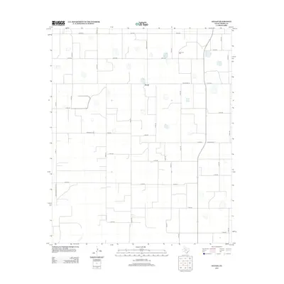
2012 Map of Savage
USGS Topo · Published 2012About this map
Savage sits at the center of this 2012 study of the High Plains in Crosby County, an area defined by its strict cardinal grid of rural transit and agricultural land. The landscape is dotted with numerous small, seasonal water basins, a characteristic hydrological pattern of the Llano Estacado. In the northeast corner, the Old Emma Cem provides a significant genealogical touchstone, marking the location of a former county seat and early settlement. The road network is primarily composed of county roads such as Co RD-182 and Co RD-121, alongside established routes like Ranch Road 2576 and Farm-To-Market Road 1525. In the southwest, the terrain begins to break away from the plateau at Plum Cr, where the headwaters of the Brazos River basin start to etch into the flat plains.
Find a feature on this map
34 named features on this map. Tap any name to fly to it.
Don’t see what you’re looking for? This feature index may not catch every label — zoom into the map to look around manually.
Map Details
Editions of this 2012 Savage Map
This is the sole edition of this map. No revisions or reprints were ever made.
Other maps of this area

1954 · Lubbock
USGS Topo · 1:250,000

1965 · Acuff
USGS Topo · 1:24,000

1965 · Slaton NE
USGS Topo · 1:24,000

1965 · Lorenzo
USGS Topo · 1:24,000

1966 · Cap Rock
USGS Topo · 1:24,000

1966 · Canyon Valley
USGS Topo · 1:24,000

1967 · Ralls SE
USGS Topo · 1:24,000

1967 · Ralls NE
USGS Topo · 1:24,000

1967 · Ralls
USGS Topo · 1:24,000

1967 · Savage
USGS Topo · 1:24,000