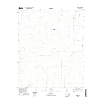
2016 Map of Savage
USGS Topo · Published 2016About this map
Emma Cem stands as a focal point for genealogical interest in this section of the South Plains, marking the site of a community that once served as a county seat. The landscape is characterized by a precise grid of rural roads, including Ranch Rd 40 and Fm 1525, which organize the agricultural territory surrounding the small settlement of Savage. These thoroughfares reflect the highly structured land division typical of West Texas ranching and farming country. In the southwestern corner, the terrain breaks its geometric pattern where the headwaters of Plum Cr carve subtle relief into the plains. This 2016 survey captures the area's modern continuity, showing how established family sites and local landmarks like Ranch Rd 1525 persist in a region defined by its vast openness and agricultural heritage.
Find a feature on this map
35 named features on this map. Tap any name to fly to it.
Don’t see what you’re looking for? This feature index may not catch every label — zoom into the map to look around manually.
Map Details
Editions of this 2016 Savage Map
This is the sole edition of this map. No revisions or reprints were ever made.
Other maps of this area

1954 · Lubbock
USGS Topo · 1:250,000

1965 · Acuff
USGS Topo · 1:24,000

1965 · Slaton NE
USGS Topo · 1:24,000

1965 · Lorenzo
USGS Topo · 1:24,000

1966 · Cap Rock
USGS Topo · 1:24,000

1966 · Canyon Valley
USGS Topo · 1:24,000

1967 · Ralls SE
USGS Topo · 1:24,000

1967 · Ralls NE
USGS Topo · 1:24,000

1967 · Ralls
USGS Topo · 1:24,000

1967 · Savage
USGS Topo · 1:24,000